Research
My research lies at the intersection of physical oceanography, numerical modeling, and machine learning. Current and past research projects include:
- Regional coupled physical-biogeochemical modeling
- Integrating machine learning and ocean modeling
- Ocean mesoscale eddies and their parameterizations
- Adjoint modeling in the North Atlantic
- Uncertainty quantification & observing system design
- Development of open source software tools
Regional Coupled Physical-Biogeochemical Modeling
In my current role, I develop methods to improve the computational efficiency of simulating physical and biogeochemical ocean processes. At [C]Worthy, our goal is to quantify the carbon removal potential of climate intervention strategies such as ocean alkalinity enhancement and direct ocean capture. To reduce the high computational cost of running many individual climate intervention experiments, I am implementing and testing a technique that allows multiple intervention scenarios to be simulated within a single physical ocean model run, without the need for biogeochemistry. I carry out this work using ROMS-MARBL and Oceananigans.jl.
Integrating Machine Learning and Ocean Modeling
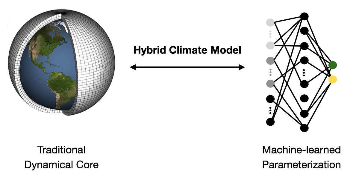
Integrating machine learning (ML) with ocean modeling offers a promising path to improving the accuracy and efficiency of ocean simulations, and plays a central role in emerging hybrid climate modeling approaches that combine physics-based and data-driven components. My work focuses on developing ML-based parameterizations for ocean physical processes, using both offline and online approaches:
- Offline learning: ML models are trained on outputs from high-resolution simulations or observational datasets before being incorporated into the ocean model.
- Online learning: ML models are trained dynamically during the simulation itself, requiring the ocean model to be differentiable.
During my work with the M2LInES Team, I focused on offline approaches to hybrid modeling. I began by diagnosing eddy fluxes from high-resolution MOM6 simulations using filtering and coarse-graining techniques. I then trained ML models on these offline datasets using PyTorch. To evaluate the model’s performance in an online setting, I integrated it into the MOM6 code base. However, offline-learned parameterizations often encounter numerical instability when coupled with the full model, highlighting the potential advantages of online approaches.
As part of the DJ4Earth project, I supervise students applying online learning techniques to improve ocean eddy parameterizations. In this approach, the machine-learned parameterization is trained alongside the simulation, requiring a differentiable ocean model with an adjoint. We implement this method using the ocean model Oceananigans, and train the ML models in Julia.
Related publications: Balwada, …, Loose et al., JOSE (2024); Yu, …, Loose et al., NeurIPS (2023)
Ocean Mesoscale Eddies and their Parameterizations
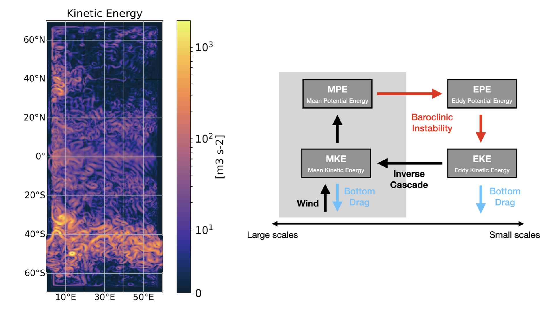
Ocean mesoscale eddies are energetic motions that have horizontal scales of tens to hundreds of kilometers. Despite their relatively small scale, these eddies play an important role in transporting momentum, heat, salt, carbon, and nutrients throughout the world’s oceans.
My research focused on the energy cycle of the ocean mesoscale eddy field: its generation, its interaction with the large-scale flow, and its dissipation. To investigate this cycle, I used high-resolution ocean models, aiming to improve the representation of mesoscale processes in global ocean models.
Additionally, I studied, implemented, and compared different mesoscale eddy parameterizations—specifically, Gent & Williams (1990) and Greatbatch & Lamb (1990)—from both theoretical and numerical modeling perspectives. My research explored how these parameterizations interact with the ocean model’s vertical coordinate system, providing insights into the consistency between theoretical frameworks and numerical implementations.
Related publications: Loose et al., JPO (2022); Loose et al., JAMES (2023); Marques, Loose et al., GMD (2022).
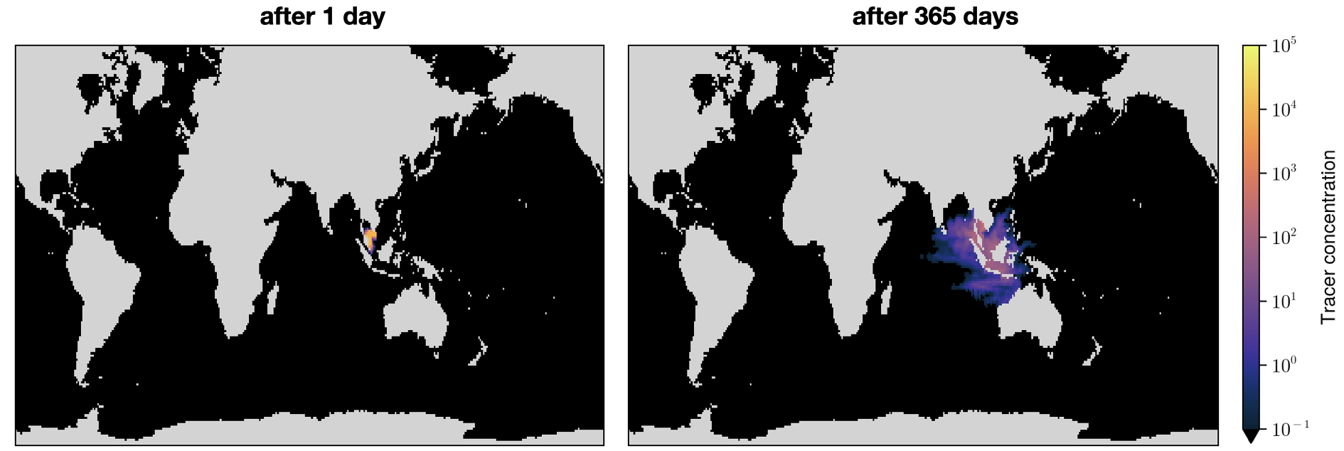
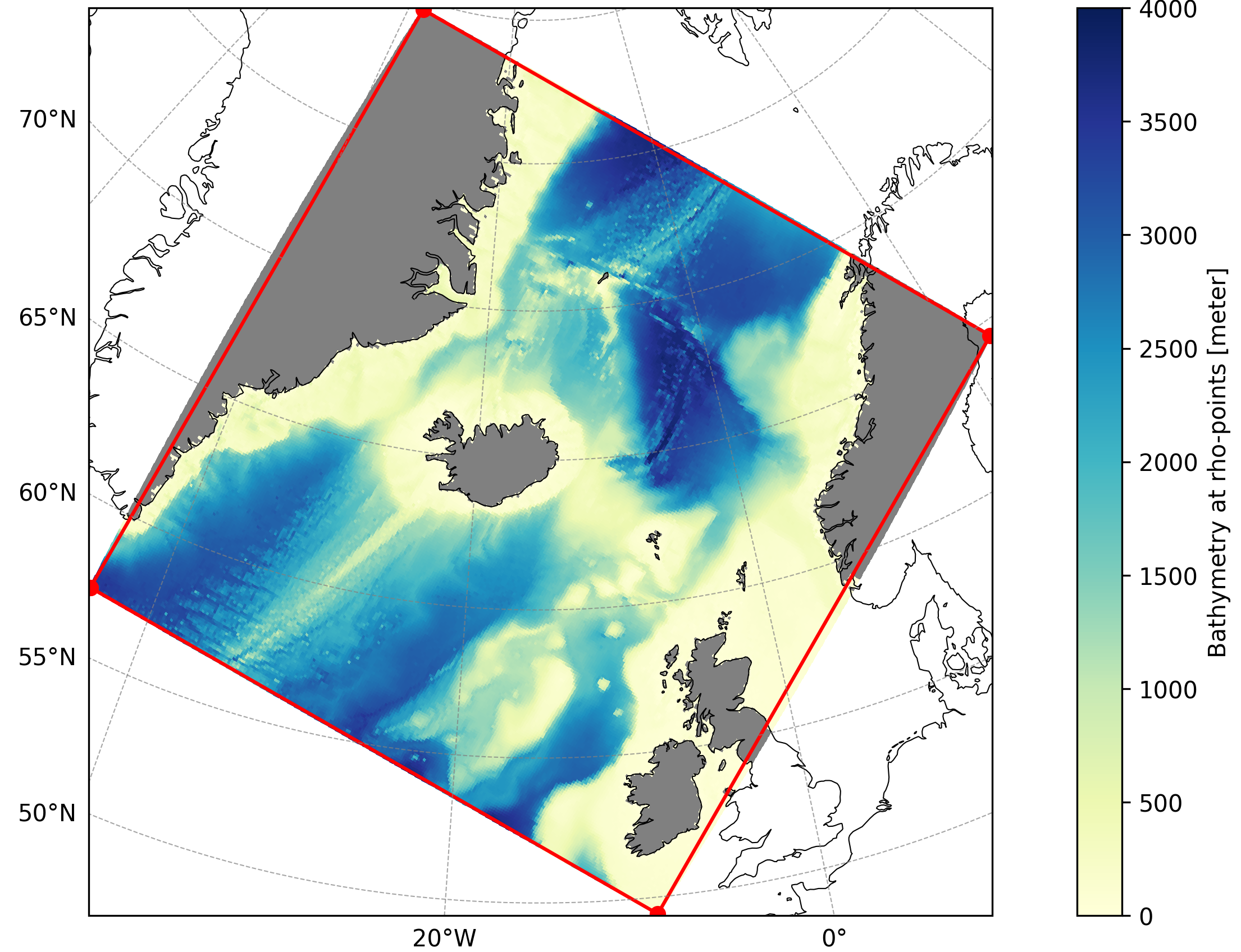
Adjoint Modeling in the North Atlantic
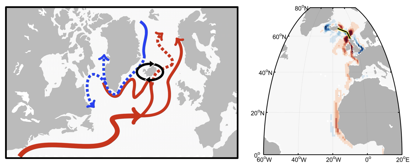
The seas around Greenland, Iceland, and Norway transport heat from the North Atlantic toward the Arctic. I used adjoint-derived sensitivities in the ECCO state estimate to identify drivers and locations that affect ocean heat transport in this region. Due to oceanic teleconnections, high-latitude heat transport is sensitive to local and remote(!) wind forcing.
Related publications: StoryMap; Loose et al., J. Geophys. Res (2020); Loose, PhD Dissertation, 2019.
Uncertainty Quantification & Observing System Design
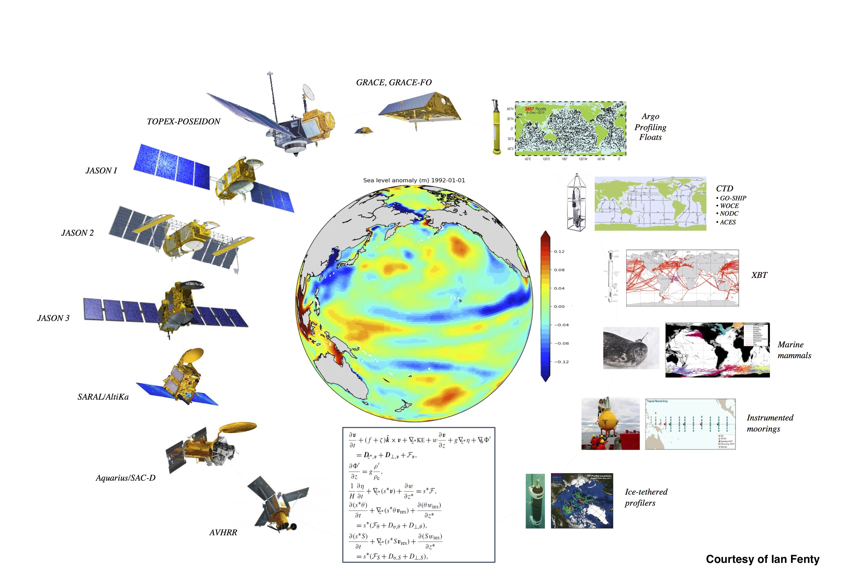
Ocean observing systems are expensive to build and maintain, and therefore have to be designed carefully. Important questions to consider include:
- What dynamical information is contained in already existing observation networks?
- What is the optimal instrument configuration, which is both cost-efficient and capable to monitor key processes and ocean variability?
To tackle these questions, I performed quantitative observing system design, through a combination of Bayesian inverse methods and uncertainty quantification in a data assimilation framework. By means of these computational tools, quantitative observing system design suggests an optimal observing strategy and supports effective instrument placements in the future.
Related publications: Loose et al., J. Geophys. Res (2020); Loose and Heimbach, JAMES (2021); Fujii et al., Front. Mar. Sci. (2019). v. Schuckman et al., Marine Policy (2025).
Development of Open Source Software Tools
I am engaged with developing open-source software tools in Python and Julia to enable our Earth Science community to perform data analysis and modeling in an efficient and reproducible way. I have led the development of two open-source Python packages: GCM-Filters and ROMS-Tools.
ROMS-Tools is a Python package for creating the input files that are necessary to run a ROMS simulation. This includes creating a grid, tidal, boundary, and atmospheric forcings, initial conditions, and more!
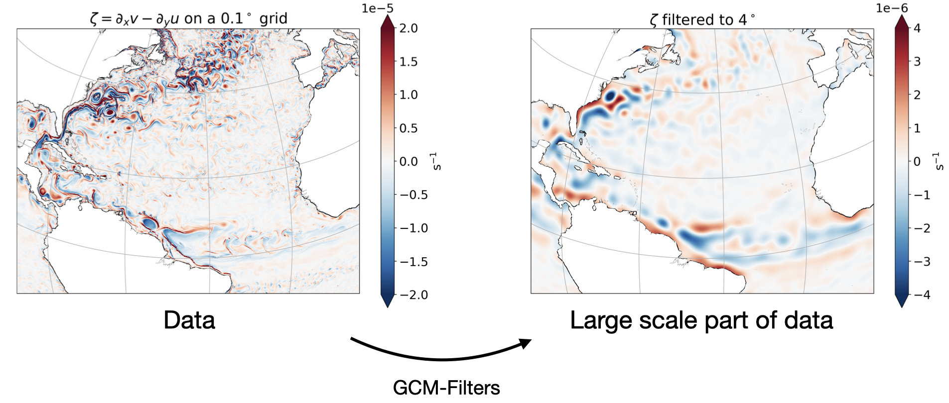
GCM-Filters is a Python package that allows scientists to perform spatial filtering analysis in an easy, flexible, efficient, and reproducible way. GCM-Filters is designed to work with gridded data that is produced by General Circulation Models (GCMs) of ocean, weather, and climate.
Check out this presentation on GCM-Filters!
Related publications: Loose et al., JOSS (2022); Grooms, Loose et al., JAMES (2021).